October 15, 2019
With red sandstone coastlines, kilometres of beaches and unique location in the middle of the Gulf of St. Lawrence, the Magdalen Islands have a magnetism like few places.
The small archipelago relies on the surrounding sea for its two main industries: fishing and tourism.
But that crisp, salty air that holds such an appeal is also a curse.
"My childhood memories are at my family beach shack, where we all laugh and cry," said Isabelle Cormier, whose cottage sits along the main road, Route 199, in Havre-Aux-Maisons.
The simple house was built by her family and cherished for generations; it has served as a gathering place for years, protected by a six-metre-high sand dune which stretched for almost 19 metres along the beach in front of the property.
But that massive, protective dune no longer exists. The cottage now sits directly on the beach, waves almost lapping at its doorstep.
"We went from having this beautiful sand dune protection to nothing — naked," Cormier said.

Erosion has always been a fact of life for the nearly 13,000 residents of the Magdalen Islands, a part of Quebec which sits about 150 kilometres northeast of Prince Edward Island.
With coastlines of sandstone and a main road built mostly on dunes, it has been considered part of the natural state of things that, bit by bit, year after year, the land slowly receded inward.
Researchers from Université du Québec à Rimouski have been monitoring erosion on the islands for decades. In one study, they estimated that from 1963 to 2008, the shoreline of the islands naturally eroded an average of 24 centimetres per year.
Isabelle Cormier speaks about the erosion that has happened in front of her family's beach shack in Havre-Aux-Maisons.
However, more recent UQAR studies have found that amount has doubled since 2005, with erosion amounting to about 46 centimetres — or half a metre — per year.
Storms, too, are normal on the archipelago. The Magdalen Islands are in part populated by the descendants of those who were shipwrecked. Two of those shipwrecks are still visible for all to see.
But things have changed in recent months, as the effects of climate change have left the area devastatingly vulnerable.
First came a powerful windstorm in November 2018. Then post-tropical storm Dorian hit in September.
The effects of the twin storms
In Cap-aux-Meules, considered the downtown core of the islands, a chunk has been taken out of a popular coastal path, as well as part of a parking lot.
It has happened before, sections receding inland slowly. But this time, the land gave way in a matter of hours, with the erosion occurring dangerously close to the region's only hospital.
The Magdalen Islands aren't typically hit with big storms in September. The hurricanes that batter the coasts of Florida and the Carolinas are usually so weakened by the time they spin this far north, local residents would hardly call them storms.
Residents say things have changed that.
"With Dorian, it was the strength of the winds," said Serge Bourgeois, who has been the director of urban planning for the Magdalen Islands for the past 30 years.
"I think that sustained winds up to 130 kilometres for hours on end had a huge impact."
Sand dunes, like those at Cormier's cottage and along the islands' eastern coast, were completely destroyed during Dorian.
But the damage was far worse because of a storm that hit just nine months earlier.

On Nov. 28, 2018, a heavy windstorm struck, knocking down power lines and damaging underwater fibre-optic cables that provide phone and internet service to the islands' residents.
"The coastlines — in particular, the sand dunes — have not had the time to recover and reform. Natural systems reform eventually when they are not too bothered," Bourgeois said.
"But we had the storm in November that weakened the coastlines. And we had Dorian, which came and weakened them even more."
Add to that the effects of climate change already being felt in the archipelago.
"The two major points about climate change are sea level rise and the ice cover reduction," said Christian Fraser, a research chair on coastal geoscience and a member of UQAR's laboratory of dynamics and integrated coastal zone management.
"The last storms were similar to storms 30 or 40 years ago, but the waves reach higher on the coast because sea level is rising four millimetres per year in the archipelago."

Near Pointe-aux-Loups, on the archipelago's north side, the shoulder of Route 199 doesn't exist anymore. Instead, orange cones warn drivers of a crumbling roadside.
Route 199 stretches from the northeastern tip of the island in Grande-Entrée, all the way to Île du Havre Aubert in the south. But much of the road lies on sand dunes.
"Route 199 is the principal road which links all the villages together to the main island, where all the services are," said Rose Elmonde Clark, a lifelong Madelinot and the mayor of Grosse-Île.
"The hospital, the [health centre], the police station and all the major services and industries are there."
Route 199 is also dotted with hydro poles, supplying most of the islands with electricity coming from the plant in Cap-aux-Meules.
The road is maintained by Quebec's transport ministry and residents are used to seeing crews at work, reinforcing the sides of the dunes with large rocks.
But sometimes that reinforcement isn't enough.

About 20 years ago, the municipality had to close a secondary coastal road in Portage-du-Cap. Parts of it are still visible, a yellow dotted line broken up where chunks of land have caved in.
The present-day Route 199 isn't the first version of that road either. Half a decade ago, another road existed but that, too, succumbed to erosion.
"I would say that 30 years ago, the land definitely was receding but it wasn't so visible, so obvious," said Bourgeois.
"Today we have these huge storms and we can see, with one single storm, that we have lost metres of land in a few hours."
Research into that erosion is made all the more difficult by the unpredictability of the storms. Across the islands, UQAR researchers have placed wooden stakes, as well as other tools to monitor the rate of erosion.
"The 2018 and 2019 storms have strongly impacted the islands," said Fraser, noting researchers are still analyzing the data from these events.
Bourgeois says he worries about the storms yet to come, as the islands are in a vulnerable state.
Protect, adapt or move
Residents recognize there's little that can be done when you're up against an increasingly angry Mother Nature.
Still, efforts both small and large are underway to buy some time and stem the damage on the islands' 435 kilometres of coastlines.
Marie-Ève Giroux and her organization, Attention FragÎles, work to give nature a hand in reforming.
"The sand dunes are really the barriers that protect all that is inside the islands," she said.

She points to work that was done at Corfu Beach. The beach is named after a ship that ran aground in 1963; its rotting metal carcass is still embedded in the sand.
Years ago, nothing stopped cars and ATVs from driving over the dunes and straight onto the beach.
All that heavy traffic created man-made openings in the dunes, weakening their structure and making them more susceptible to wind and water during storms. As a result, the loose sand could easily shift and blow away in the wind.
"We put fences up and created one access to the beach," said Giroux. "We also kept only one trail open for ATVs and hunters to use."
Then her team got to work. They placed wooden stakes, branches and even lobster traps across the breaches in the dunes.
"Those structures all have the same function: they catch the sand," she said.
"It slowly closes the breaches and helps to rebuild the sand dunes … We also transplant beach grass. The roots of the grass are really strong and keep the sand dunes together."
The municipality also invests in work to reinforce certain areas of the archipelago. A commission has been created solely to deal with erosion.
But money is an issue.
"The problem we have in the Magdalen Islands is that with a population of 12,800 permanent residents, we have a limited capacity to pay," said Bourgeois.
According to Bourgeois, the municipality is prioritizing the reinforcement of the cliff downtown — a project that is expected to cost more than $15 million alone.
The Quebec government says it takes the changes seriously. A new provincial action plan on erosion is due out before the end of 2019.
Throwing in the towel
At times, though, the municipality just has to throw in the towel.
That's what's happening along Chemin des Chalets, a popular spot along the coast for cottages.
Once protected by a sand dune, Dorian hit that part of the islands perhaps the hardest.
Many cottages were ripped off their moorings and tossed along the road. Others were completely destroyed.
Some residents left late in the night, Bourgeois said, water already up to their waists.

"Sometimes adapting means stopping the fight, abandoning the fight," he said. "We can't protect everything. We need to make choices, change habits."
Others, like Jacques Solomon, know the risks and take them anyway.
For decades, Solomon has had a cottage along the coast in Bassin on Île du Havre Aubert.
He admits it's a gamble.
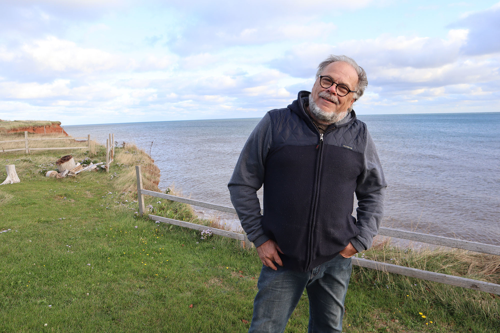
"In 30 years, I've lost 75 feet of land," said Solomon, standing near the edge of his property, which abruptly drops to a beach below.

"Probably, in 50 years, I will have to quit — but I won't be here anymore. I know this, it's how it goes with the sea."
A few years ago, Solomon paid to have his cottage moved about 10 metres inland. He recently built another home behind the cottage and moved in there full time.
Every few years, he moves his small wooden fence farther back from the coast, before it falls victim to erosion and into the sea below.
"I know when I bought this five years ago, my new home, that it would be for me. But I can't leave it to my children. In 30 years, I think maybe, the sea will be there."
Why stay?
Despite the challenges, the allure of the Magdalen Islands remains strong.
Many residents born there go away for university. But the pull of the sea, fresh air and beautiful landscapes lures them back.
"We have a beautiful island. It's called the jewel of the province of Quebec — but sometimes the jewel comes with a price," said Clark. "In the summertime, I don't see any other place better to live than here."
Most residents echo that statement.
"Yes, the islands are disappearing and yes, it costs money. But it's also about the occupation of Quebec territory," said Bourgeois.
"The Magdalen Islands are part of Quebec's territory, in the heart of the Gulf of St. Lawrence. I think that's important."

Solomon agrees.
"We stay in the Magdalen Islands because we love the place. We stay near the sea because it's attractive. But we have to pay for it," he said.
The uncertainty of the future is worrying though, especially for families who have called the islands home for generations.
"We don't know how long, with the climate change, it'll take for the roads to really erode badly — worse than what they are now," said Clark.
"I don't know what the future holds for us. But hopefully my grandchildren and great-grandchildren will be able to stay here on the island."
