April 22, 2021
In an old flight suit from the Second World War, with a .22-calibre rifle slung over his shoulder, Ernest Partridge would spend hours inspecting dikes along the Upper Bay of Fundy.
The Dorchester, N.B., resident was looking for holes to repair, or driftwood and debris to clear away, often walking more than 200 kilometres a week.
As an aboiteau superintendent with the Maritime Marshland Rehabilitation Administration, he knew he couldn’t stop the tide from galloping in twice a day — but for 13 years he did his part to keep it contained.
"At that time, foxes were noted for making dens in the dikes, too," said Partridge, who was first hired a year out of high school in 1948. "If you saw a fox and you knew that he was close to making a hole in the dike or had made a hole in the dike, you just eliminated the hole-maker."
Now, at 91, he’s still proud of his role in the long tradition of protecting the land near the border of New Brunswick and Nova Scotia from the powerful tides, a practice that began with the Acadians in the early 1700s.
But he also knows that the structures that have fascinated him since he was a child now face a far greater threat than foxes.
Partridge’s hometown sits near a vulnerable strip of land known as the Chignecto Isthmus. It connects Nova Scotia to the rest of Canada and it's under threat due to rising sea levels.
Residents, local leaders and experts all say it’s only a matter of time before the dikes fail, and it's why researchers are now looking at ways to protect the coast by using a technique that’s even older than the dikes: the marshlands themselves.
"I think it's absolutely urgent that we act on this now," said Danika van Proosdij, a professor at Saint Mary's University who is helping to lead natural restoration projects in the Chignecto area.
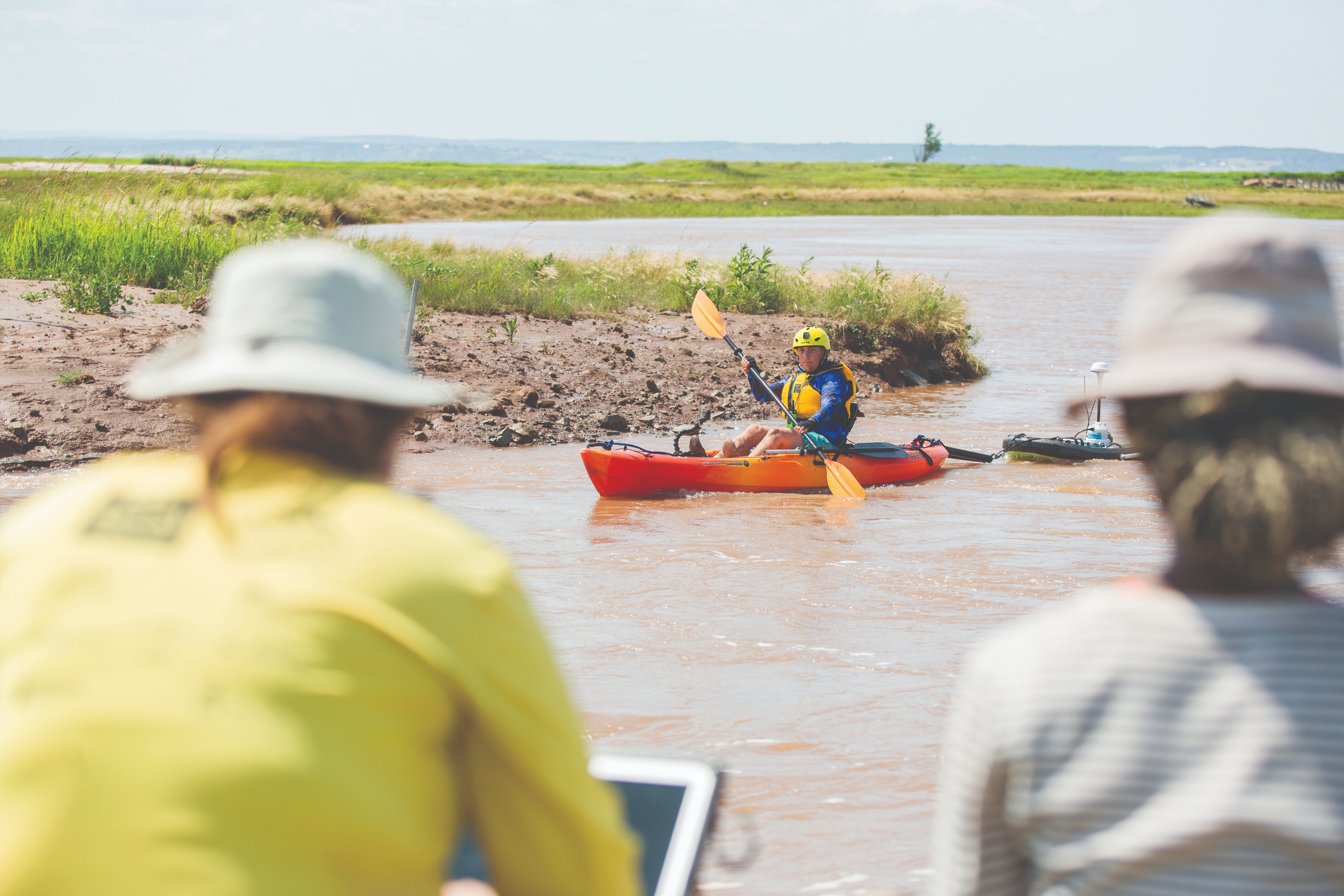
The method involves breaching the dikes, and moving them further back, so that saltwater can once again flood the marsh. Once the tidal flow returns, plants spring up in front of the dike and become a natural buffer to the waves.
It will now be up to governments in New Brunswick and Nova Scotia "to make some tough choices about where to hold the line and where to allow it to move back," van Proosdij said.
The provinces, along with the federal government, are getting ready to release a $700,000 study this spring. It will put forward three recommendations for dealing with the threat to the Trans-Canada Highway and CN Rail track that cut directly through the isthmus.
The story of Siknikt
The Chignecto Isthmus, flanked on either side by the mammoth tides of the Bay of Fundy and the Northumberland Strait, is part of the Mi'kma'ki district of Siknikt, which translates in English to "the drainage area."
Long before some $50-million worth of goods travelled through the transportation corridor each day, the region was rich in resources of a different kind — whales, seals and caribou — and an important meeting place for the Mi’kmaq.
"It's very centered in Mi’kmaw territory," said Trevor Gould, curatorial assistant for the Mi'kmawey Debert Cultural Centre. "It's almost like all roads lead to Chignecto."
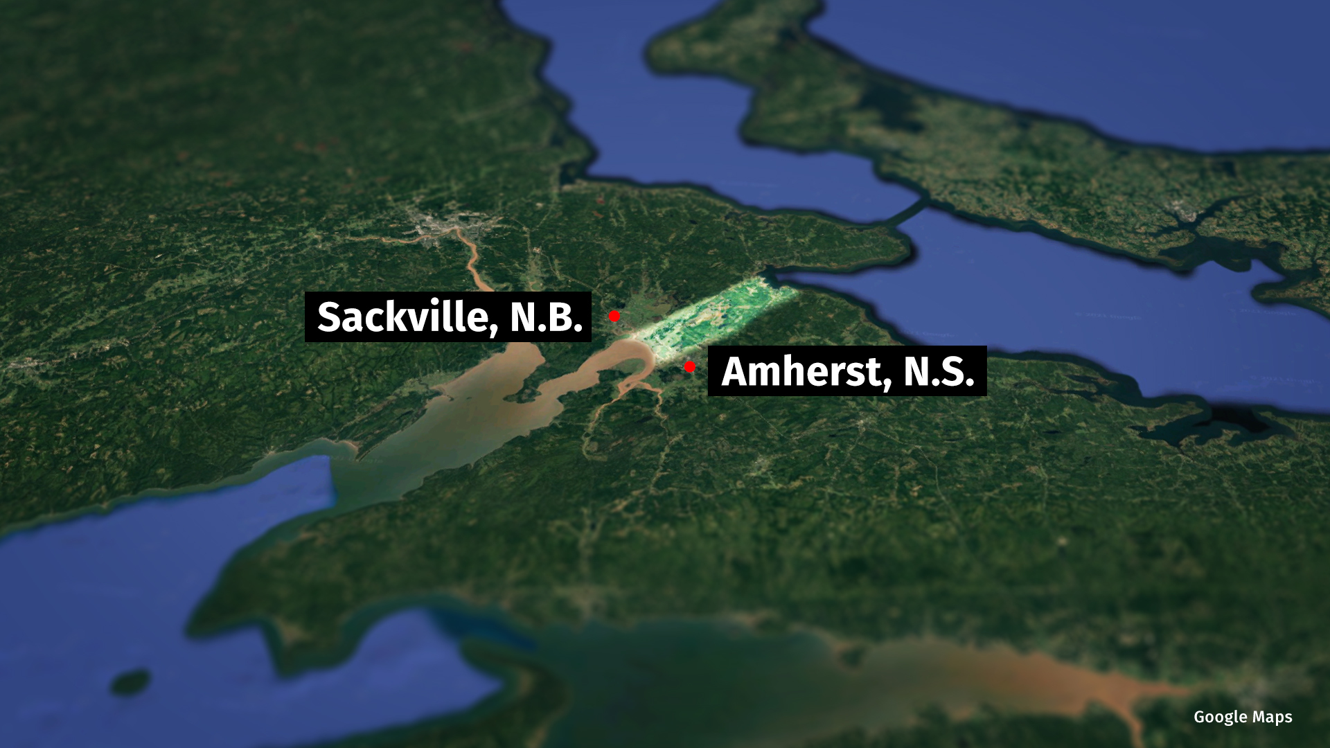
Gould is in the early stages of working with Parks Canada to showcase the 13,000-year history of the area so that "people will start appreciating it more than just a drive-through area that connects the provinces."
"It was such a heavy place during the treaty process between the Mi’kmaq and the British," Gould said. "It was a hub for leadership. It was a centralized place where Mi’kmaw people respected the leadership there and sought it out."
He wants Canadians to learn the real story of this place, one that predates the more well-known narrative of industrious Acadians who constructed an intricate system of dikes and aboiteaux that carved fertile farmland out of a vast expanse of marshland.

When the Acadians arrived in the region in the 1670s, they got to work.
Whole communities could spend months constructing dikes and aboiteaux, the sluice gates that are placed beneath the dikes to let fresh water out and stop the seas from entering during high tides.
"All these lands were already reclaimed or diked before 1750, so you can imagine the amount of work that was put into this diking and aboiteaux-building. It was very, very impressive," said Ronnie-Gilles LeBlanc, an Acadian historian whose ancestors settled in Beaubassin, one of the main communities along the isthmus's Tantramar Marshes.
Beaubassin was a key spot for trade and was fought over by the French and English. It was burned to the ground in 1750 and later rebuilt.

In the flood zone
Over the years, many of the Acadian dikes were replaced or heightened, but more than 300 years later, it’s still the same technology keeping the tides in check.
Only now, instead of crops and cattle, they’re protecting larger communities like Sackville, N.B., and Amherst, N.S., and major transportation routes like the Trans-Canada Highway.
Most of the dikes Partridge would have patrolled 70 years ago are about eight metres high — large spring tides can reach seven metres.
Experts say it won’t take much for a storm surge or high tide to breach the barriers, which also happen to be subsiding, and soak inland areas in saltwater.
"We potentially could be cut off through our transportation gate," said research scientist Tim Webster with the Nova Scotia Community College.
"The amount of traffic, both truck traffic, transporting goods and, of course, rail traffic could be compromised and certainly delayed."

A 2018 study by van Proosdij and other geographers at Saint Mary's University found that 70 per cent of the dikes in Nova Scotia are vulnerable to a one-in-50-year storm.
And scientists say things will only get worse, based on projections that sea levels could increase by as much as a metre in parts of Nova Scotia by 2100.
"That equivalent storm surge in the future would even overtop the dikes more, and once a dike is overtopped then we have the possibility of erosion and then more breaching and it could be a catastrophic event," Webster said.
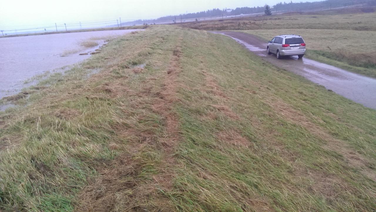
This is what the mayor of Amherst, a town nestled at the northeast end of the Cumberland Basin, is fighting to prevent.
David Kogon says the conservative estimate is that 80 Amherst residents and businesses are located in the flood zone, but it could be a lot more.
He wants to see a limited number of salt marshes return to the area to help protect the town, while also preserving farmland.
"It would be lost if there is no mitigating action taken," Kogon said. "Most of the connection between Nova Scotia and New Brunswick would be completely cut off by water, permanently, if nothing is done."

If that were to happen, John Atkinson’s family farm would be under water.
He lives just west of Amherst where the LaPlanche and Missaguash rivers meet before they empty into the Cumberland Basin. An eight-metre dike separates his hay fields and pasture from the powerful Bay of Fundy.
Small pieces of driftwood now litter the top of the dike, and in some cases, have been pushed behind the barrier — a warning of how far the saltwater has come.
"The salt in the seawater is definitely not good for your crops out there. It takes a lot to get the salt back out again of the soil, a number of years," Atkinson said.
"And generally if it comes over once, it will probably come over again."
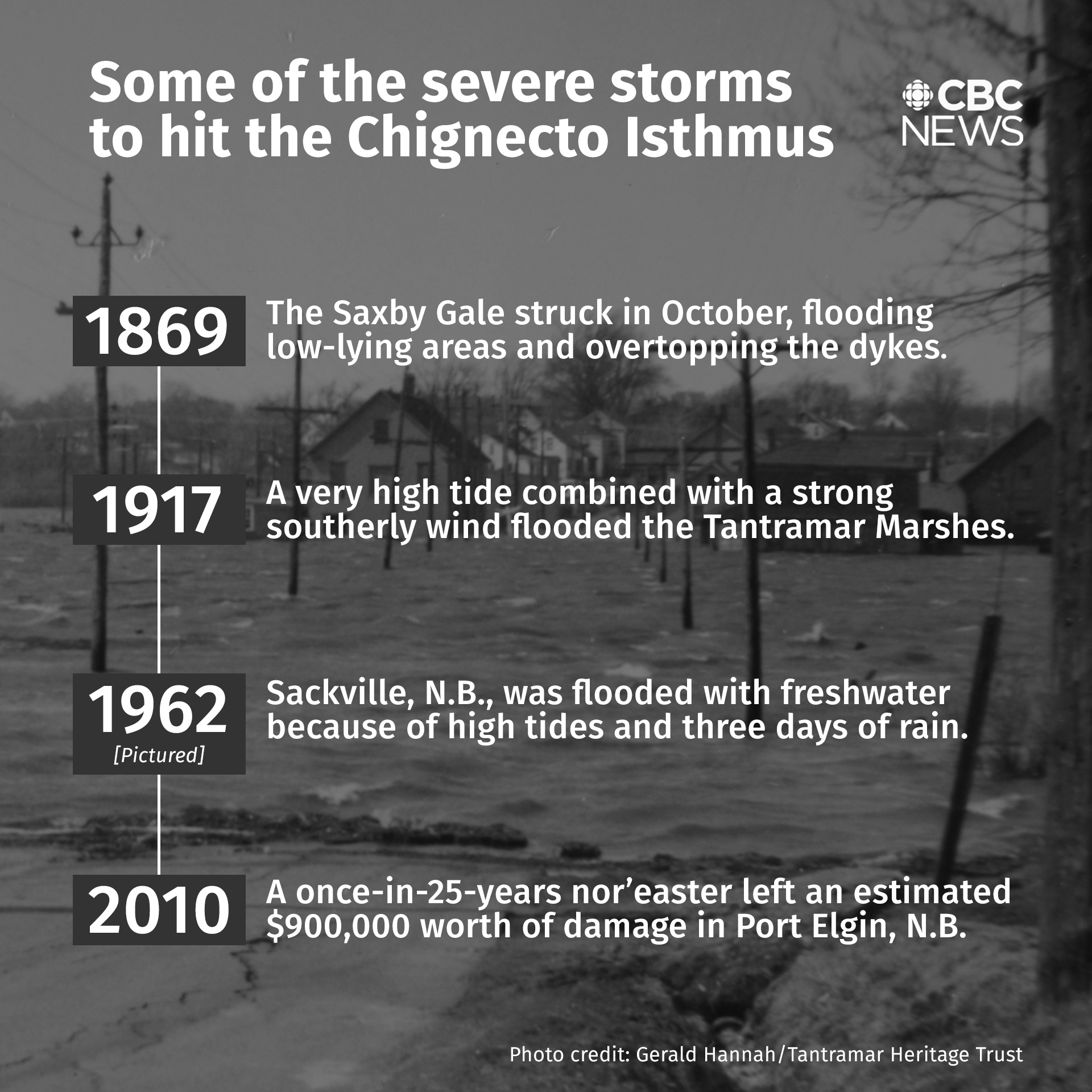
Atkinson, like many people who live in the Chignecto Isthmus, often worries of the worst-case scenario: another Saxby Gale.
The tropical cyclone that struck the region over two days in October in 1869 flooded hayfields and washed away entire barns and grazing cattle.
According to one account from the time, a mare and her colt were seen floating on a haystack across the Bay of Fundy to the New Brunswick hamlet of Rockport, alive and largely unharmed.
In the wake of the devastating storm, communities worked together to rebuild the dikes along the Tantramar Marshes that had been destroyed.

Allowing the water to return
But given the realities of climate change, it would be very difficult to fortify dikes in all the vulnerable areas of the Chignecto Isthmus, said van Proosdij.
Instead, her team is using a process known as managed realignment to let the salt marshes return and create their own natural protection against the tides. For the past few years, the researchers have been visiting two sites, the Converse Marsh site in Fort Lawrence and another on the Cornwallis River.
“We're allowing nature to regain a position where it formerly was in the past,” van Proosdij said.
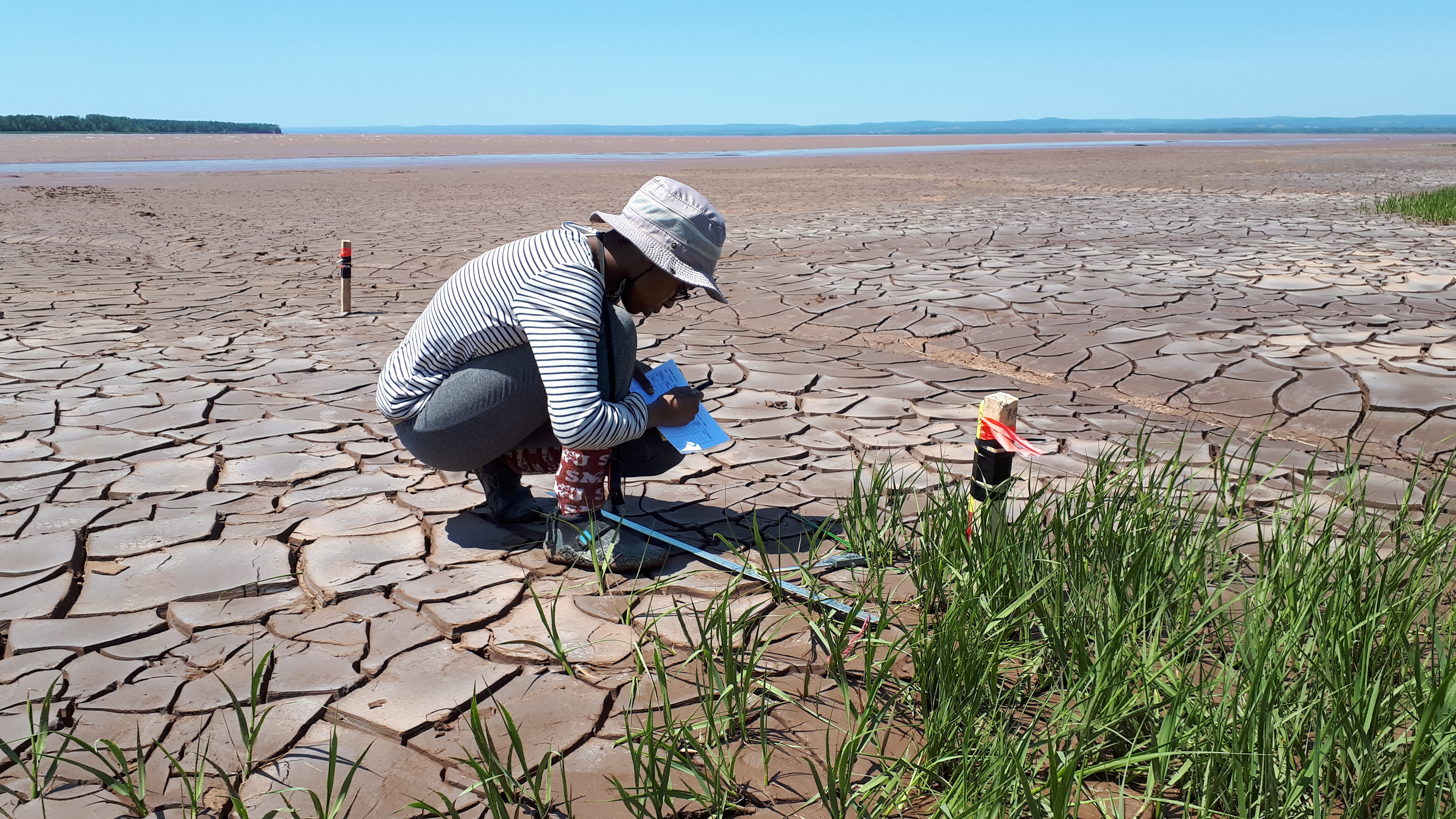
At the heart of this new approach are plants native to the salt marshes that help break the force of the wave. Over time, thanks to the steady tides, the plants grow taller and stronger and trap more sediment, becoming a more effective barrier.
Saint Mary's student Makadunyiswe Ngulube said the team’s results are promising. They show that wave energy is reduced by over 60 per cent within the first 10 metres of the marshy area, and by 100 per cent at 50 metres.
The results are dependent on a few things, including how big the plant is, whether it bends with the impact of the wave and how big the waves are.
“Oftentimes we find that the plants would bend, and if they do bend, they still reduce some wave energy or they still reduce some wave heights because they act as a barrier or an obstruction or they provide a friction surface,” Ngulube said.
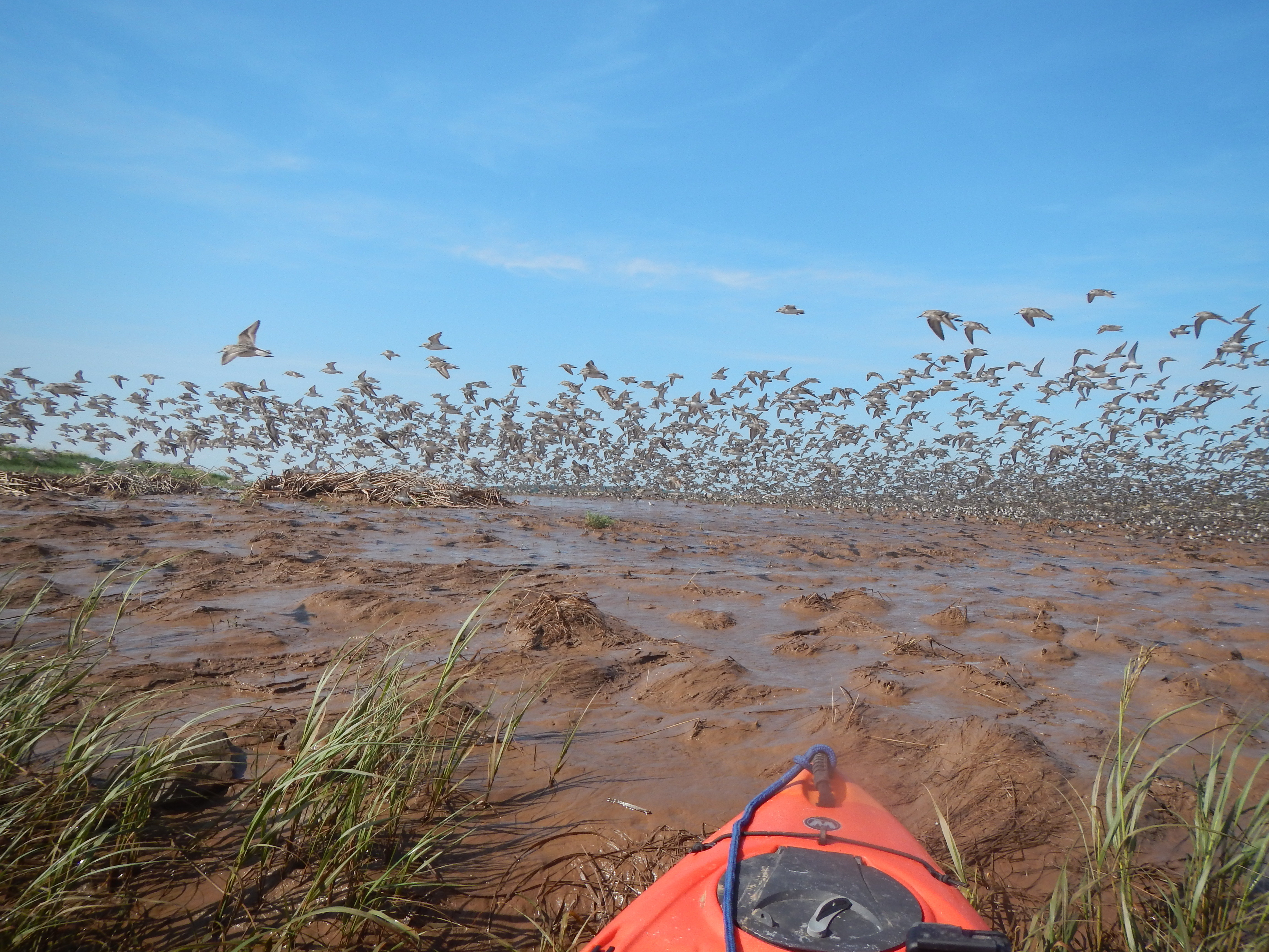
People who live and work in the Chignecto area have mixed feelings about the kind of landscape van Proosdij and her team are proposing.
“By nature, I'm an environmentalist or ecologist so from that sense ... I wouldn't have any problems with that," said LeBlanc, whose Acadian ancestors helped build the dikes.
"On the other hand, as a historian, yes, it does bother me because, I mean, it's part of our heritage and it's the way it is.”
With that, he paused and added, “We have to change with the changing times and maybe it's something that we have to accept.”

Waiting for the storm
For Nova Scotians and New Brunswickers who live in the Chignecto Isthmus, climate change isn’t a far off threat. They’ve weathered powerful storms and watched the tides grow higher.
But even so, it tends to take the back seat to more pressing issues, like a global pandemic.
Partridge, the retired aboiteau superintendent, has been sounding the alarm about the condition of the barriers for more than a decade. He worries people aren't hearing him.
“They don't realize how serious a problem it is until they look out some day and they see the marsh where they cut hay that fall is underwater,” he said. “It's going to happen, it’s bound to happen if they don't do something.”
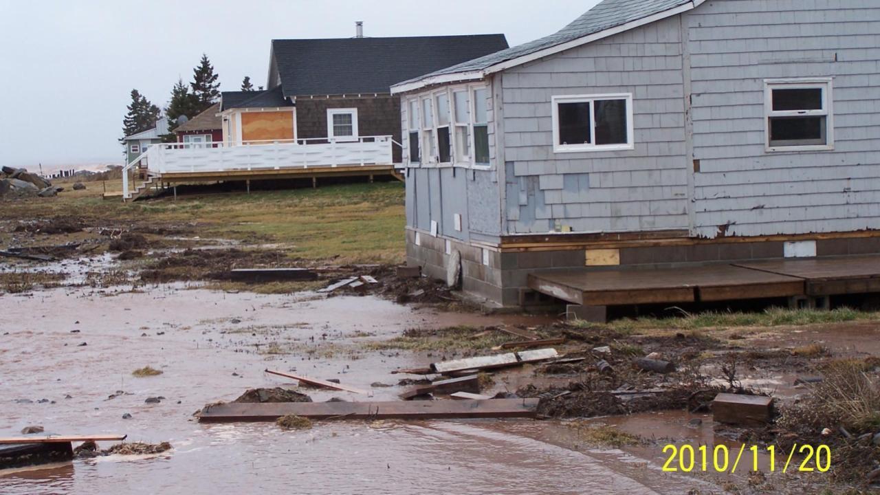
Across the isthmus from the Bay of Fundy, the coast of the Northumberland Strait is facing erosion and powerful storm surges up tidal rivers. In 2010, several cottages in Port Elgin, N.B., were swept away by a once-in-25-year nor’easter.
Tim Murphy’s cottage was picked up, turned 360 degrees and thrown back about 20 metres. He said he later spent $30,000 to move his cottage back to the shore.
“I'm taking a chance right back to the same spot," he said. "[I] put a little more rock in front of it and said, well, if it happens again, it's my loss."
Murphy is the EMO co-ordinator for the small village, located on the shores of the Northumberland Strait.
Like many people who live in the region, he's gotten very good at watching for signs of another Saxby Gale.
He studies the tides and winds, and tracks the movement of the moon, as he waits for the next crisis he knows will come.
“People, they'll think about climate change when there's an emergency going on and they'll say, gee, that was quite a storm," he said. "But after that, they get complacent and they don't talk about it.”
Listen to the full radio program 'At the Crossroads', a joint production by Information Morning Halifax and Moncton:
